I moved the reading list to a separate page under the blog title.
I moved it on August 26, as I have begun to discover the limitations of using a blog for adding, searching and retrieving particluar types of information: general messages, lists...
Clearly the blog is effective for capturing the temporal release of information but maybe a website is better for???
Thursday, August 12, 2010
Wednesday, August 11, 2010
Online Mapping
I'm a little overwhelmed by the number and variety of online mapping applications. In this post I will try to limit the selections to applications that allow users to create their own maps, rather than the more speciliased functions of trip planning, mapping and display, etc.
Scribble maps
Mapme.com
OpenStreetMap
Wikimapia
Scribble maps
Mapme.com
OpenStreetMap
Wikimapia
Monday, August 9, 2010
Map Tools
Google Planimeter measure areas using Google Maps
Maptimize clusters multiple markers that are in proximity
Online Mapping Services
Here's the start of a list of online mapping services. I expect the list to grow, have URLs added, be sorted into different categories of functionality, and have brief annotations.
- Yahoo
- Ask
- Multimap
- Mapquest
- MSN
- Maporama
- Maps.Com
- Rand McNally
- Maps On Us
- Map24
- maps-for-free
- Holiday Maps
- StepMap
Sunday, August 8, 2010
Geocoding addresses
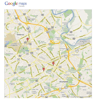
Here is how to quickly assign geographic coordinates to street addresses using the online program called, batchgeo
First, prepare a set of street addresses in a tab delimited format. Here's an example I typed into a spreadsheet:
First, prepare a set of street addresses in a tab delimited format. Here's an example I typed into a spreadsheet:
|
Trip Display
Another category of applications related to trip planning and trip mapping is for the presentation of pictures from one's trip using various enhanced display functions.
TripWow
SmugMug
loc.alize.us
Trip Planning
The most prevalent use of online services today may be for mapping, and in particular for route planning and wayfinding. This is not surprising given that to aid navigation is the most fundmental function of the map, (along with measurment and visualization). This posting begins a list of route and trip planning software.
MapQuest
Trip Advisor
MapMyRide
Gmaps Pedometer
Trans-Canada Trail
Trans-Canada Highway Trip and Vacation Planner
Subscribe to:
Comments (Atom)
